© Copyright Todd Neel
9/8/2024 Sunday – I’ve been too busy driving and experiencing the journey to document it in real-time, so I’m doing catch-up writing here.
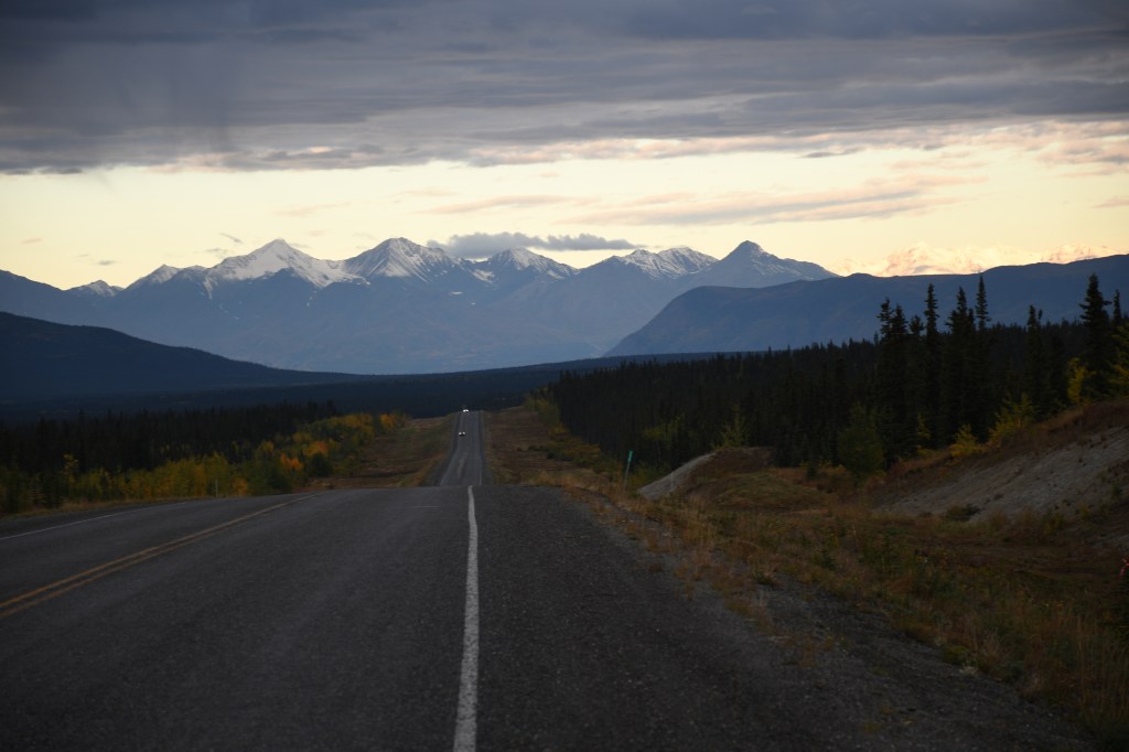
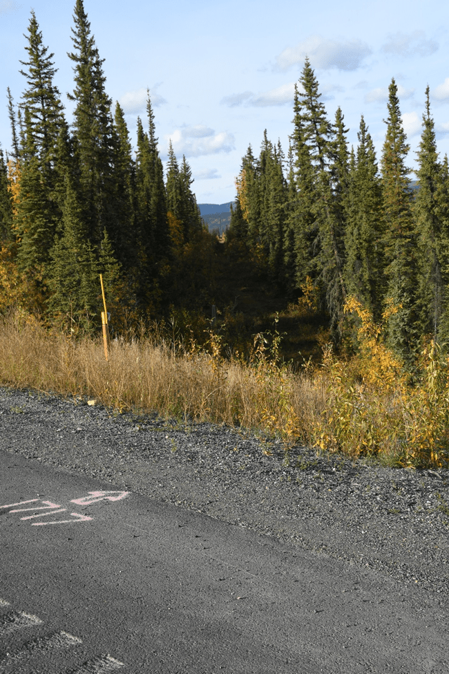
I drove from my “Camp under the Power Lines” in Canada – my last camp in Canada during the trip north, which lasted 7 days. This dirt road is between Champagne and Canyon on the Alaska Highway. (I refer to my journey north because I may be returning this way on my trip south back home at the end of September.)
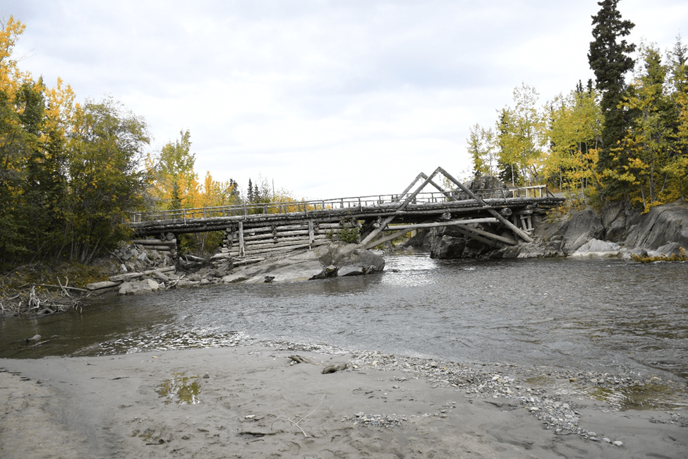
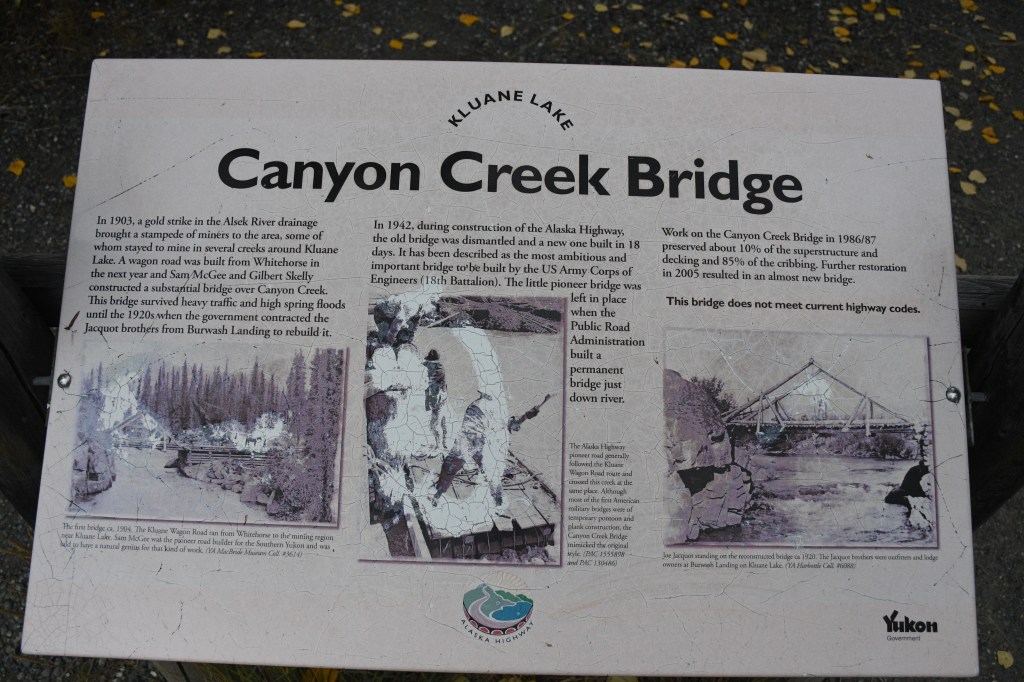
In 1904 this bridge was built for The Kluane Wagon Road which ran from Whitehorse, Yukon to the mining region near Kluane Lake. It is no longer safe and is closed to vehicle and pedestrian traffic.
Today, I spend time at the Visitors’ Center in Haines Junction, Yukon, CA. I visit with a nice staff person, Kate, which includes talking about our health as elder people – her husband had a heart ablation procedure due to atrial fibrillation (a-fib). I share that I had open heart surgery for heart valve replacement on February 1 of this year (6 months ago) and that I had a-fib for a while, but it was resolved, and now “I’m fine!” (Being “fine” and “fixed” is an illusion.) I also share with Kate that I have Macular Degeneration, and I want to see Alaska before I can’t see Alaska and points in between, including the Yukon.
I share that I’m on this month-long trip of a lifetime, traveling alone because my wife is getting over a recent knee replacement surgery, that she’s had two hip replacements, and she doesn’t like to go on such long rides.
I viewed exhibits at the Visitors’ Centre. I watched a 20-minute movie on the Indigenous people, the land, and Kluane Nation Park Preserve, which covers the lower southwest corner of Yukon, Canada. This park has the largest non-polar ice field in the world, with many, many glaciers – which are out of view of the road I’m travelling on and unviewable from this town. Still, there are visible snow fields that look pretty serious, what look like permanent snowfields high above the tree line.
Mount Logan, Canada’s highest peak at (5959 meters/19,551 ft.) is in the back of the Kluane National Park. It can’t be seen from the road. It’s accessible only by airplane or very long hikes.
I have been feeling like I am in a foreign country – well, of course, I am – it’s Canada! There are no Trump signs! I see many Indigenous First Nations people and Caucasians with large noses most likely from French heritage. I don’t recognize my genetic stock of northern European white people! Where are my Celtic people? Where are the red heads? I am an immigrant here, as I am in the U.S.
People I talked with had accents of all kinds, including tourists from Asia.
The roads over the last hundred miles in Canada were terrible, with frost heaves and potholes in the pavement, gravel patches, and dust clouds from long stretches of road under repair. But crossing into the U.S., the roads were instantly in better condition, at least for a few miles (maybe the U.S. was trying to make a good first impression). The U.S. roads had newer pavement and fewer frost heaves, and the gravel stretches looked like they were actually going to get around to paving them before this winter! In the U.S., there was actual road construction where you saw workers and equipment moving and flaggers where we stopped and waited our turns before moving on (I don’t remember that in Canada.) When there were U.S. road repairs, there was better signage warning drivers of broken-up roads.
I passed through the westernmost community in Canada, a little town called Beaver Creek. One of the staff members at the Visitor Centre said he had lived there for over 60 years, since 1961. We talked about Canadian roads, and he said they are actually better in the winter because the holes get filled up with snow and ice, and they keep them well-plowed. The Visitors’ Centre is closed in the winter because of frozen pipes.
This westernmost town in Canada, Beaver Creek, has a Canadian entry station for south/eastbound traffic nearby, but the actual international border is not for another 20 miles/30 km beyond. Then there is the U.S. Border entry station a few hundred yards further for the west/northbound traffic going into the U.S.
I cross the U.S. border into Alaska about 6 pm, stop, take pictures, and read the signage.
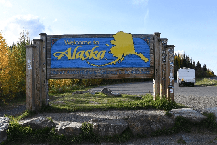
As I cross the border, I know it is Alaska and I’d never been here before, but it feels like being back home in the U.S. I see a “Trump” sign in Alaska, notably absent in Canada.
At the actual border, there is a swath of trees cut out on the international line with specific U.S./Canada markers. This is the 141st meridian of longitude, which marks the boundary between Yukon and Alaska. It extends from the Arctic Coast to Mount Saint Elias, 1,538 miles/2,475 kilometers. This border between Canada and the U.S. is the longest undefended boundary in the world.
International U.S./Canadian border.
Alaska has another time zone to get used to, one hour beyond the Pacific time zone where I live. Yet there is still some confusion on my part here as to whether they are on Daylight Savings Time or not – I later Googled it and found that the 49th state here is on Daylight Savings Time with most of the rest of the U.S.
After about 20 miles in the U.S., I came to a rest stop at the trailhead of Hidden Lake, AK. There are several large piles of bear scat right next to the pavement at the rest stop/trailhead, much larger than the black bear piles in Idaho. This led me to believe these were from “Brown Bears,” or what we call Grizzly in the Lower 48. I thought of hiking down the trail in the morning, but I decided against it!
I drove 258 miles today.

Leave a comment